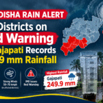


Bhubaneswar, October 26, 2026: Cyclone Arnab Odisha preparations have intensified as the storm strengthens over the Bay of Bengal and moves towards the Andhra Pradesh coast. The India Meteorological Department (IMD) reported that the cyclone was moving westwards at around 15 kmph and could intensify into a very severe cyclonic storm on October 27 before making landfall on October 28.
The developing weather system has prompted Odisha authorities to strengthen disaster preparedness in vulnerable districts. Officials are monitoring the situation as the cyclone’s movement could bring heavy rainfall, strong winds and other weather-related risks to parts of the state.
Cyclone Arnab: What Is the Latest Weather Forecast?
According to the IMD’s coastal weather bulletin issued on October 26, Cyclone Arnab was centred over the east-central and adjoining west-central Bay of Bengal at 5.30 am. It was located approximately 650 km east-southeast of Visakhapatnam in Andhra Pradesh.
The weather department forecast that the storm would strengthen into a severe cyclonic storm by the night of October 26 and could become a very severe cyclonic storm on October 27. It is expected to move northwestwards and cross the Andhra Pradesh and Yanam coasts between Bapatla and Visakhapatnam by the morning of October 28.
At landfall, the IMD forecast maximum sustained winds of up to 125 kmph, with gusts reaching 140 kmph. The exact effects on individual locations will depend on the storm’s movement and intensity as it approaches the coast.
Odisha Government Strengthens Disaster Preparedness
The Odisha government has stepped up precautionary measures in response to the cyclone forecast. According to a report published by The Tribune on October 26, the state has mobilised resources in six vulnerable districts: Ganjam, Gajapati, Rayagada, Malkangiri, Koraput and Nabarangpur.
Chief Minister Mohan Charan Majhi has deputed eight ministers to monitor preparations at different locations. Rescue teams from the National Disaster Response Force (NDRF), Odisha Disaster Rapid Action Force (ODRAF), Fire and Emergency Services and police have also been positioned in vulnerable areas.
The state has prohibited fishing activities at sea and restricted tourist entry to hills, waterfalls and dams in the six identified districts. Schools, colleges and Anganwadi centres in these districts are scheduled to remain closed on October 28 and 29, according to the same report.
These measures are intended to reduce exposure to hazardous weather and help authorities coordinate emergency response operations.
Rainfall and Strong Winds: Possible Impact on Odisha
Although the current forecast points to landfall along the Andhra Pradesh coast, Odisha could still experience adverse weather as the system moves inland.
The IMD’s October 26 coastal bulletin reported moderate to rough sea conditions along both the north and south Odisha coasts. It also listed distant warning signal No. II at Paradip and Dhamra ports, and local warning signal No. IV at Puri and Gopalpur ports.
Heavy rainfall and strong winds may disrupt transport, electricity supply and normal activities in affected areas. Residents in vulnerable locations should remain attentive to updated district-level warnings, particularly where heavy rain could affect low-lying areas or create difficulties for road travel.
The severity and distribution of rainfall will depend on the cyclone’s eventual track. Residents should therefore rely on current IMD forecasts rather than assume that every district will experience the same conditions.
NDRF Teams and Emergency Arrangements
Disaster response teams have been placed in vulnerable areas to support local administrations if the situation deteriorates. The deployment of NDRF, ODRAF, fire services and police personnel forms part of the state’s broader preparedness measures.
The administration has also cancelled leave for employees in the identified districts and opened control rooms to coordinate relief and rescue operations. The agriculture department has advised farmers to harvest and safely store crops that are around 80–85% mature.
These precautions are particularly relevant for communities that may face heavy rain, waterlogging or disruption to essential services.
How Did Cyclone Arnab Get Its Name?
The name Arnab was contributed by Bangladesh to the regional list of tropical cyclone names. The naming system for cyclones over the North Indian Ocean, including the Bay of Bengal and Arabian Sea, is coordinated through the World Meteorological Organization and the United Nations Economic and Social Commission for Asia and the Pacific.
The name identifies the weather system for official communication, forecasts and public advisories. It does not, by itself, indicate the storm’s intensity or the level of damage it may cause.
What Should Residents Do Now?
As Cyclone Arnab approaches the eastern coast, residents should monitor official weather bulletins and instructions issued by their district administrations. People in vulnerable areas should follow evacuation directions if authorities issue them and avoid unnecessary travel during severe weather.
Fishermen should comply with restrictions on going to sea, while residents should stay away from rough coastal waters, flooded roads and other hazardous locations. Farmers should follow local agricultural advisories to protect harvested and standing crops.
Cyclone Arnab Odisha preparedness remains important as the storm develops, with October 27 and 28 expected to be key dates for monitoring its movement and associated weather. The latest IMD bulletins and official government advisories will provide the most reliable guidance on rainfall, wind conditions and safety measures for individual districts.